There are many historic maps of the railroads in the Birmingham area (including the BMRR) which were produced at various times and for various purposes. Many of those maps are available digitally. Only a few examples of such maps are shown below, and other, more extensive sources can be accessed such as the Cartographic Research Laboratory at the University of Alabama, the Birmingham Rails website, and holdings of the Birmingham Public Library–both digital and hard copy.
EXCELLENT ON-LINE HISTORIC MAPS OVERLAY TOOL:
In addition to the historic maps presented below, if you are interested in overlaying historic maps onto current maps, the United States Geological Survey has provided an excellent resource for doing that. Many of the historic maps that can be overlaid at that website show the Birmingham Mineral Railroad (usually as “L & N Railroad”), and the overlaying capability will enable you to see where it ran in relation to present-day maps. Visit the USGS Historical Topographic Map Explorer website at http://historicalmaps.arcgis.com/usgs/ See the Links to Resources page on the Bham-MRR.com website for INSTRUCTIONS for using that online map overlay tool.
NOTE: Generally, clicking on an image below will enlarge it for better viewing.
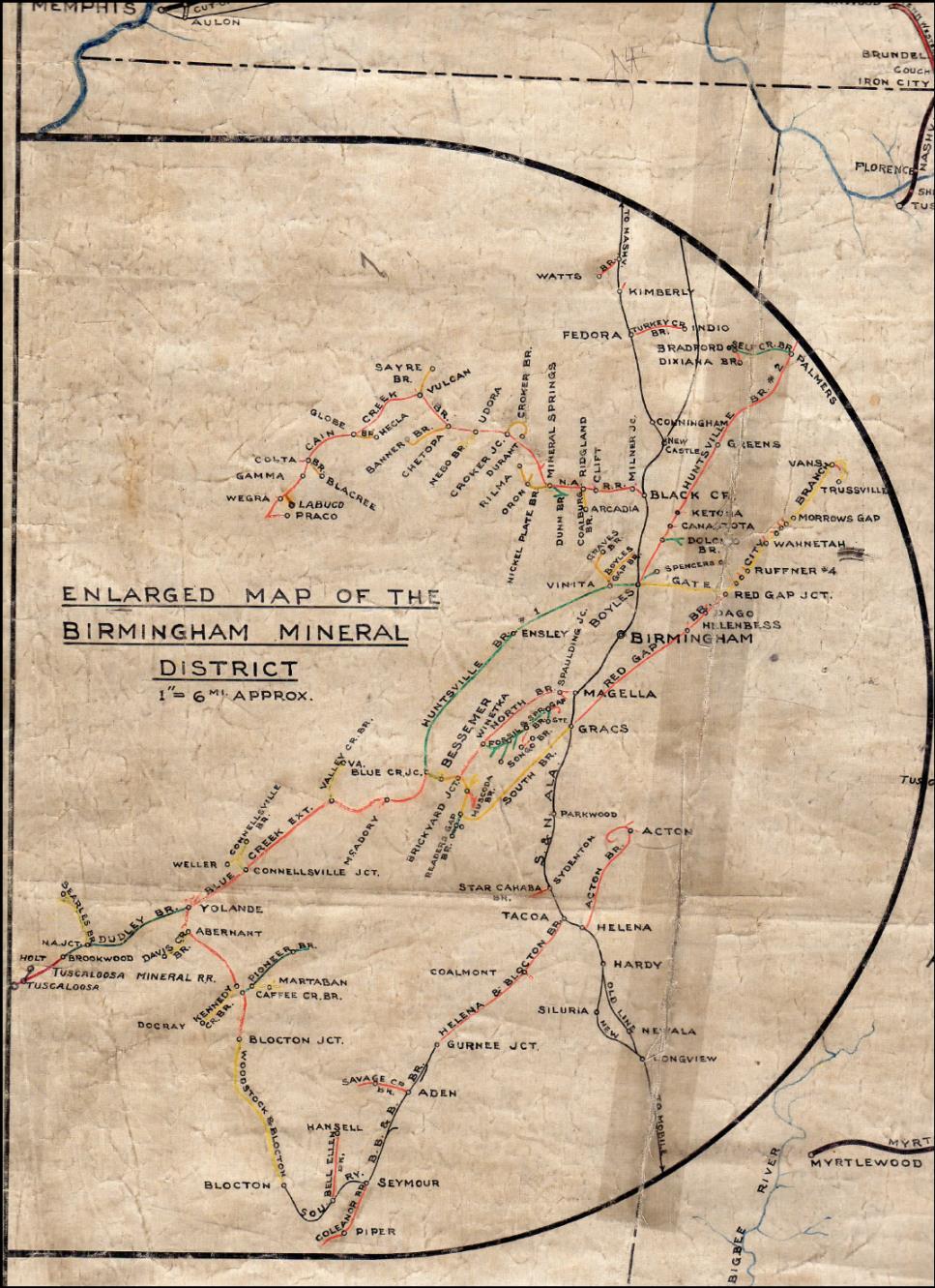
Map Date: 1911 Source: Kelley Company “Kelleys’ [sic] Railroad, Mine, and Industrial Map of the Birmingham Mineral District” [NOTE: To view a higher resolution image of this map, click here to contact us.]

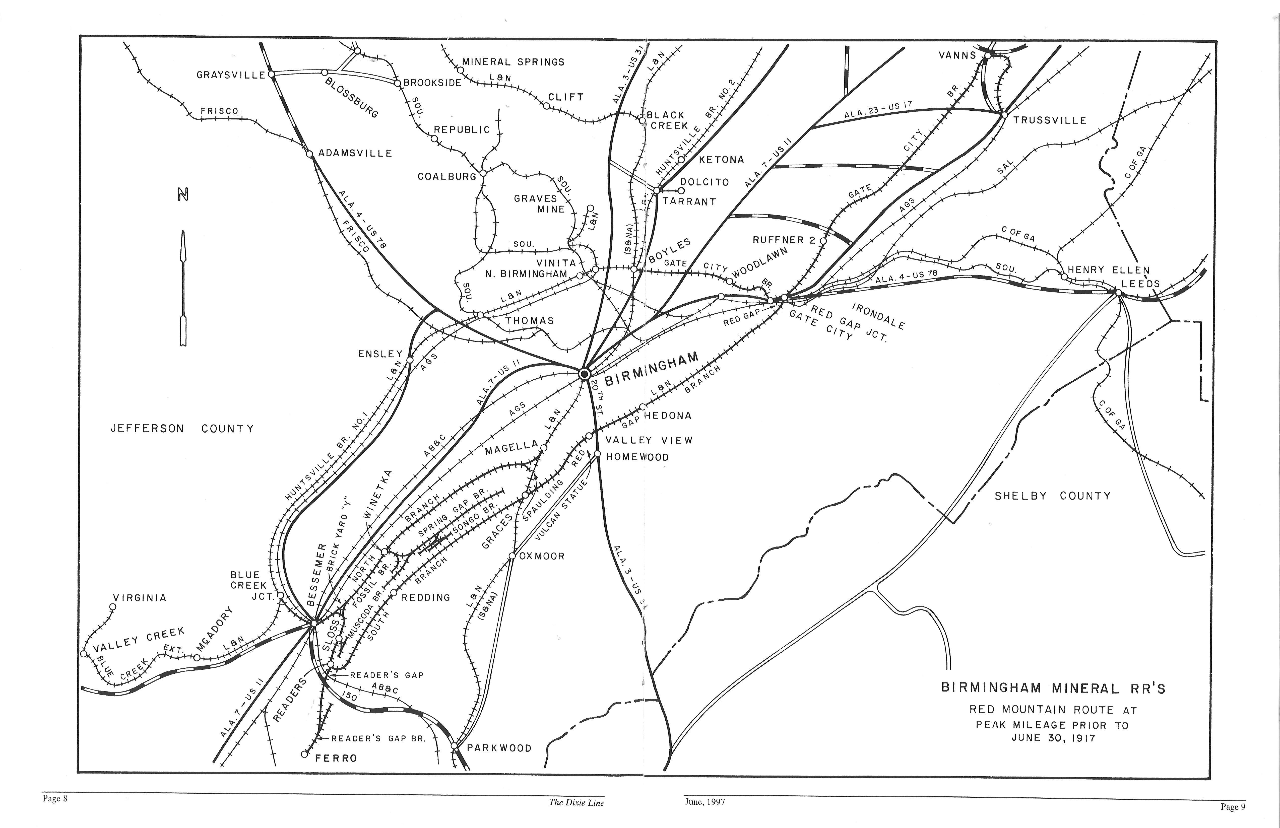
Map Date: 1917 Source: The Dixie Line June 1997
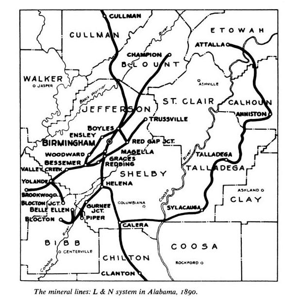
Map Date: 1890 Source: History of the Louisville and Nashville Railroad
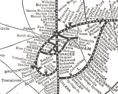
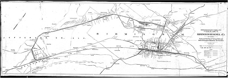
Map Date: 1914 Source: University of Alabama Cartography Research Lab.
Map Date: 1935
Valley View Mine near Vulcan Trail with current-day features superimposed:

Courtesy of Gary Bostany.
Source: HAER No. AL-45; ALA 37-BIRM, 47
View of Valley View Mine when it was operational:

The following map is an inset from an original drawing on linen of the L&N railroad system, dated February 8, 1910, revised May 9, 1927:
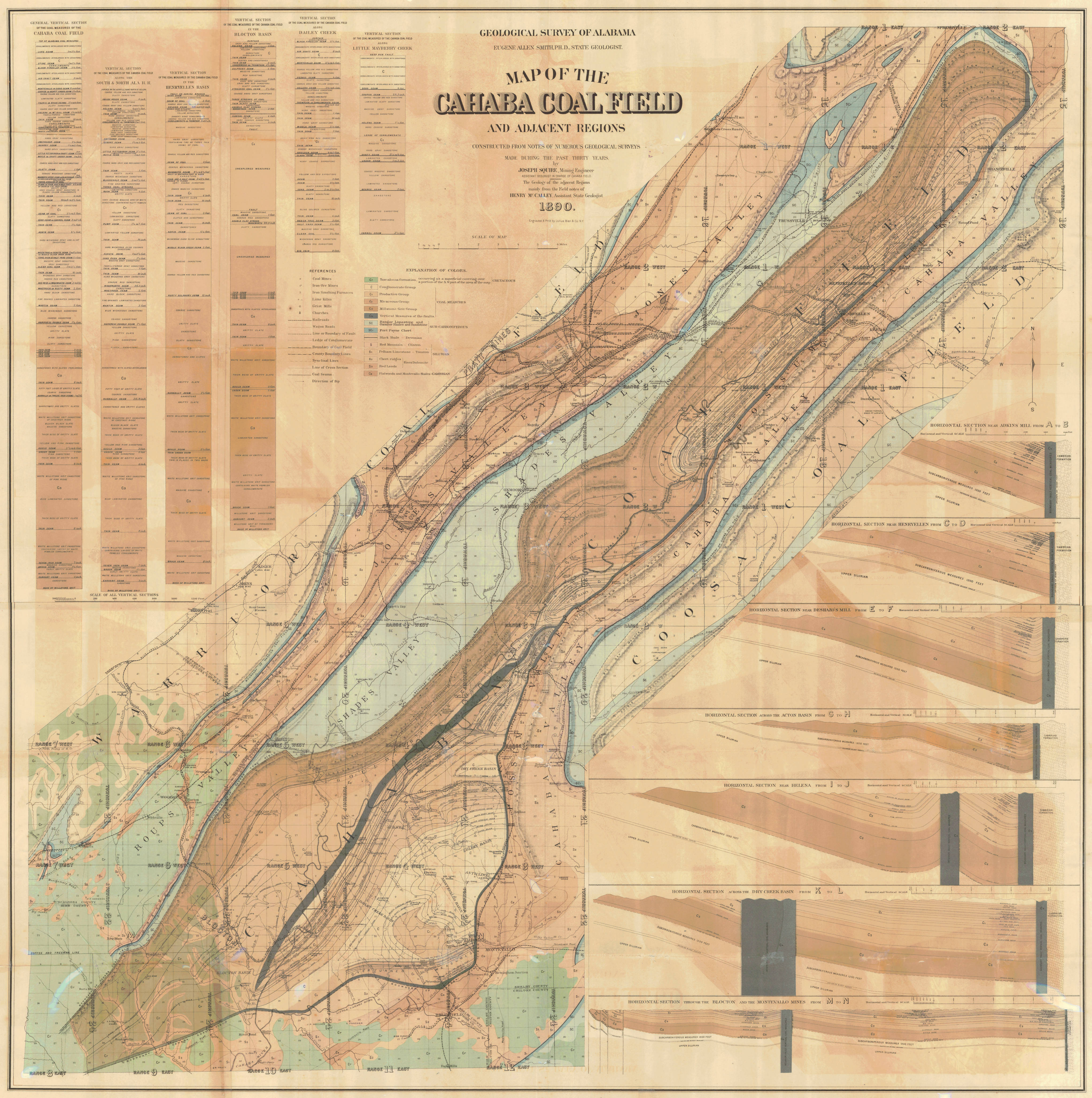
Map Date: 1890 Cahaba Coal Field (shows the BMRR branches serving the Cahaba Coal Field)
Map Date: 1916 TCI Birmingham District — Color added by City of Birmingham staff
